| Year: | 2021 |
| Tools: | Illustrator, Photoshop |
| Fields: | Graphic Design, Online Education Design |
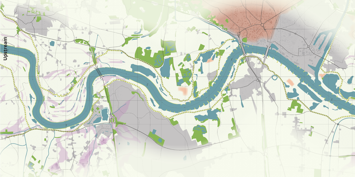
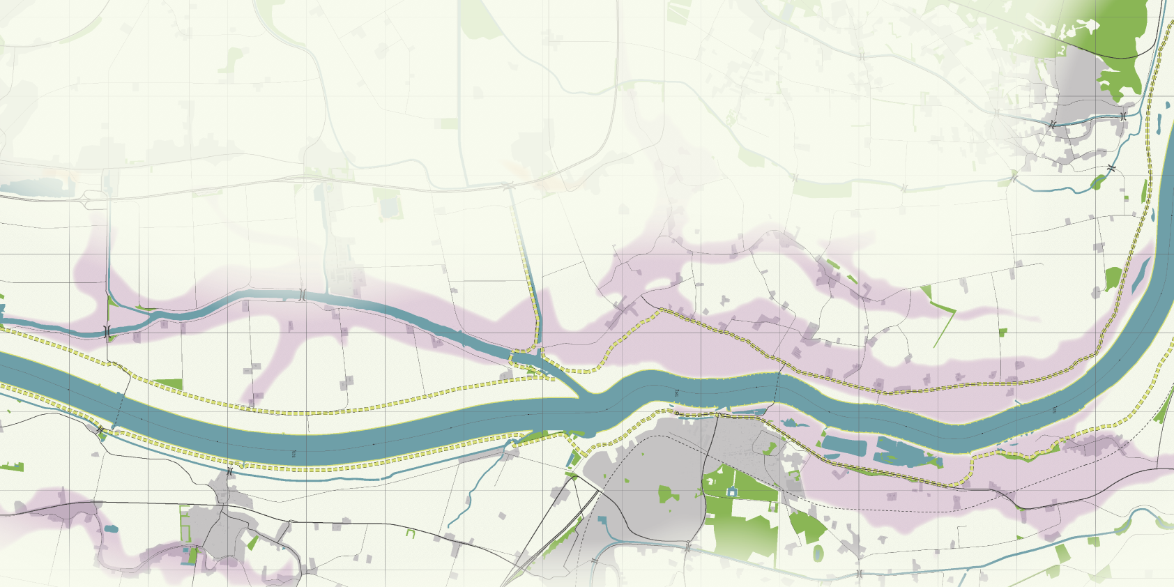
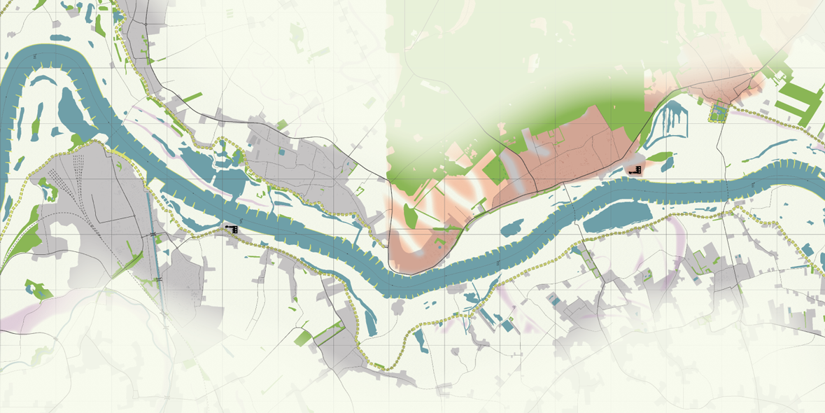
For an upcoming Massive Open Online Course (MOOC) on river interventions that aim to reduce flood risks, I designed a fictional river that wil be used for the assignments in the course. The map will be linked to a web application. Students will use the map to come up with designs for river interventions, that can be entered in the application, which in turn will give feedback to the students about the effect of their chosen interventions in terms of flood risk reduction, costs, and suitability.
Process
The map is based on real river interventions that have been completed in the Netherlands in the last decade. I used pre-intervention era topographic maps as a base for distilling the required layers that students need for the assignments. Next, I traced the maps in Illustrator and changed the appearance of each layer to better suit it's new use.
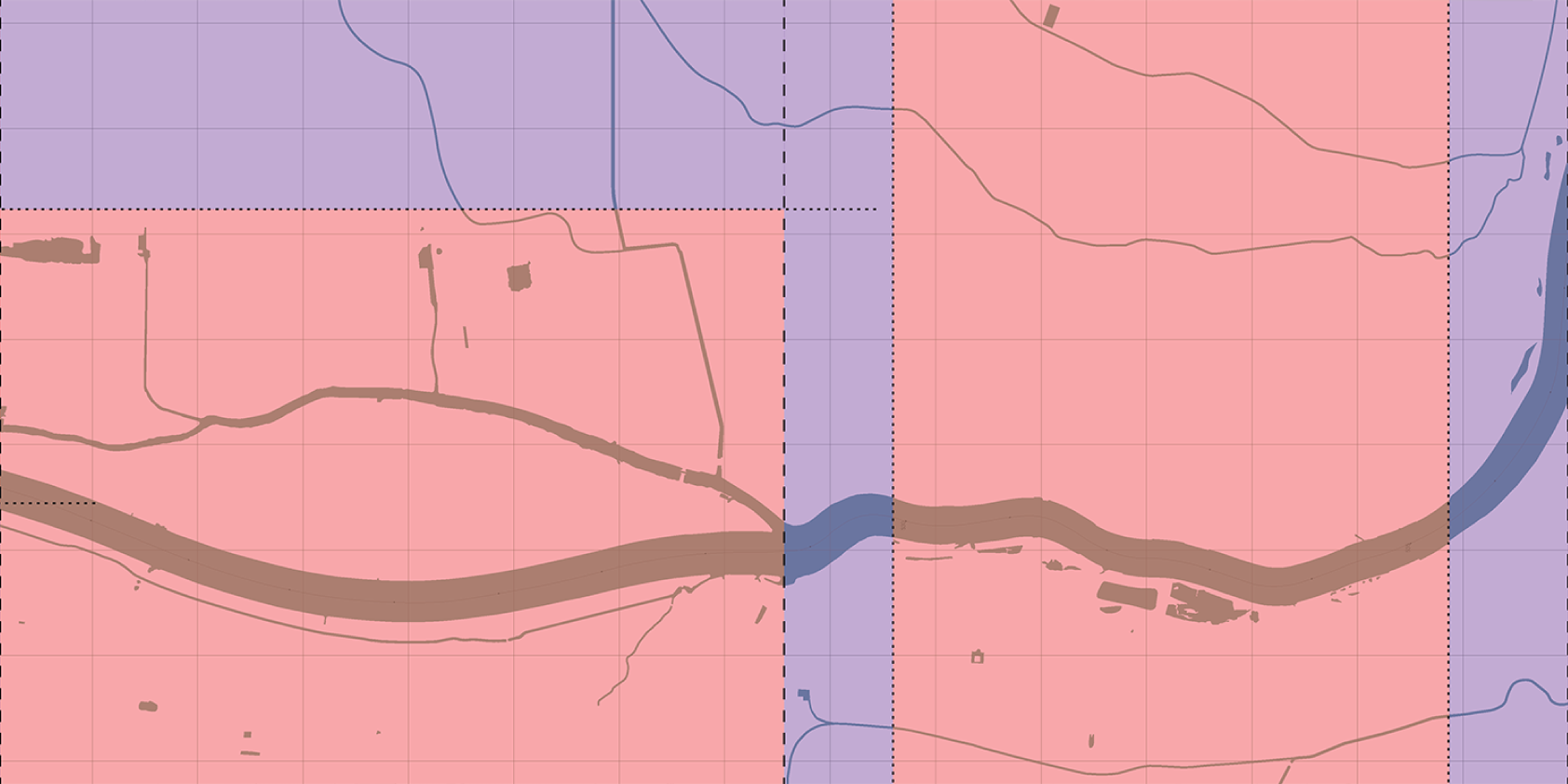
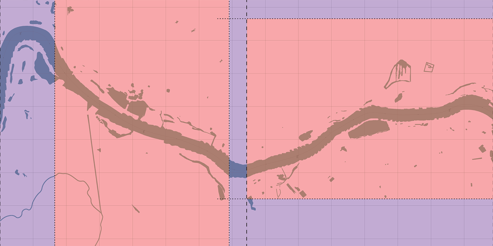
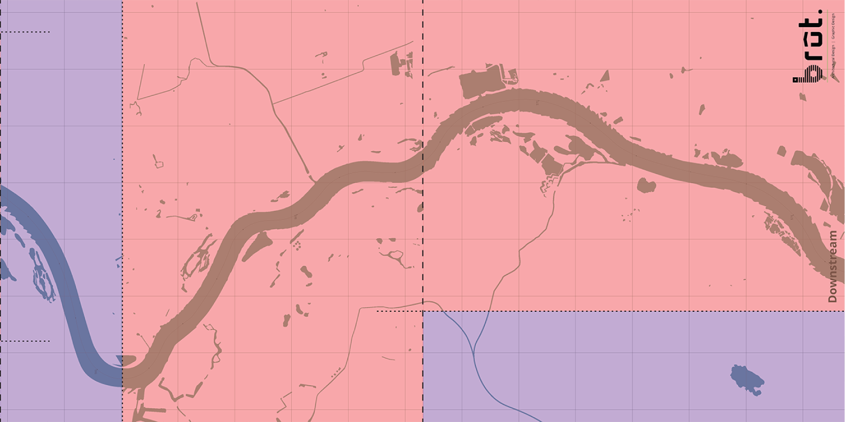
The following step was to ‘glue’ the separate maps from the reference locations together, to form one continuous river. The aim was to erase the hard transitions between the reference locations, so that students experience a continuous river. Another requirement was that the river flow rate would be equal throughout the entire river. However, the reference locations all have different flow rates, so I had to split some maps in the center of the river and pull them apart to match width and flow rate.
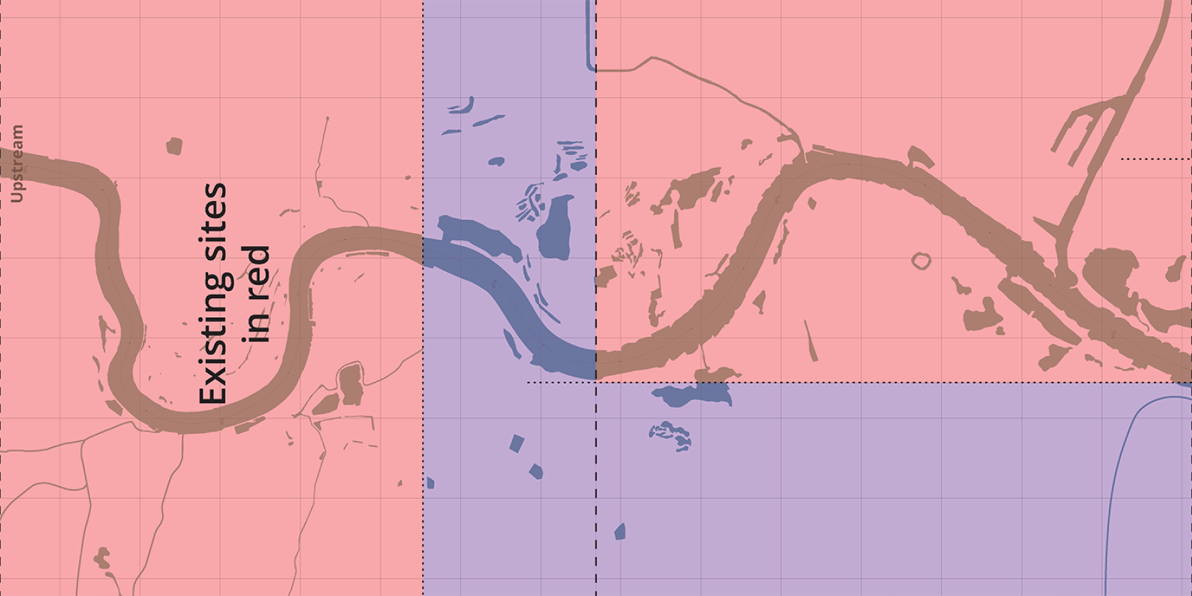
The final step was to fill in the gaps that were a result of the ‘glueing’. The dual image below shows how this was done. The parts in red are the reference project locations, whereas the parts in purple contain a fictitious landscape designed by me. I used my knowledge about city planning and river systems to complete the map in an as realistic way as possible, being sensitive to the context of the reference locations.